Massive snowstorms followed by torrential downpours.
Brutal winds gusting to 70, 80, even 90 miles an hour.
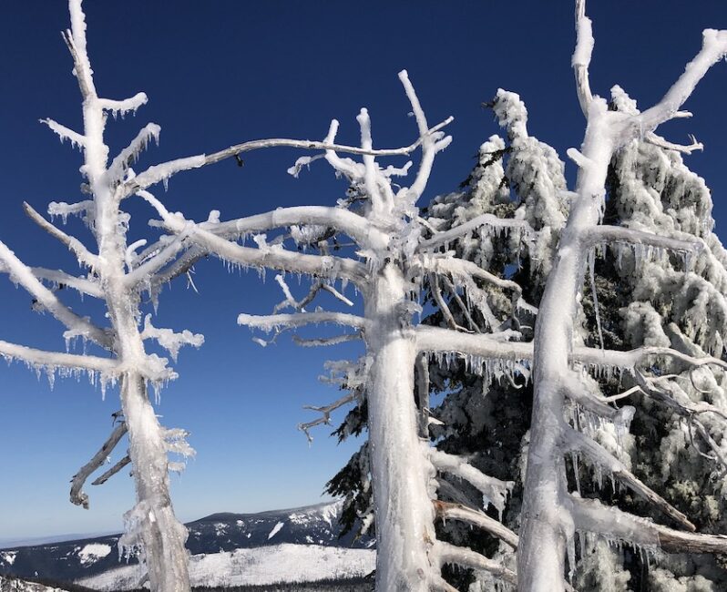
Full-mountain freeze-downs followed by Herculean de-icing labors.
Has there ever been a more extreme weather year on Mount Hood?
The La Nina extravaganza of 2020-21 has created enormous challenges for mountain employees and road crews and epic opportunities for skiers and snowboarders. More than six feet of snow fell in a week in mid-February, and when the precipitation shifted to freezing rain it turned mountain roads into skating rinks and chairlifts into icicle galleries.
Mt. Hood Meadows ski patrol crews rescued dozens of skiers and snowboarders from the Mount Hood Express chairlift on Sunday, February 14th after the lift froze up. Timberline was forced to shut down operations entirely for several days after a power outage caused a key water pump to fail. A few days after that problem was fixed, Timberline’s Pucci lift failed, and 42 people had to be evacuated to safety over a three-hour rescue operation by ski patrol.
And then the snow returned once again. Every time the mountain freezes over solid this winter, a snowstorm moves in to bury the ice. As of Friday, February 26, the snow depth at 6,000 feet on Mount Hood is 178 inches, or nearly 15 feet. And the Weather Service has issued yet another Winter Storm Warning predicting yet another 2-3 feet of fresh and winds of 55 mph or more.
Is this the wildest Hood season ever? I posed that question to Mt. Hood’s own self-taught snow expert Temira Lital, and here is her take on 2020-21:
This feels “normal” to me for a La Nina year. The defining quality of La Nina is that the PNW is in the bullseye of the storm track. There’s no guarantee of the direction the storm track will take at any point in the season. This can result in powerful systems coming from the NW (dumping powder), W (lots of snow, but not necessarily the lightest), or SW (rain, mixed precip, freezing rain). Strong wind is also characteristic of a La Nina year thanks to the proximity of the jet stream.If I remember correctly, my first couple of seasons on Mt. Hood involved many days where we couldn’t run lifts, so this definitely isn’t the wildest. I’ve been in the area over 20 years, and one thing I’ve noticed is the massive decline in lower-elevation snowpack. Those orange stakes by the side of the road at Little John or Parkdale elevation aren’t needed any more, sadly.
Extremely Extreme Weather Extremes
The quality of snow lately has been extremely good on Mt. Hood lately. But just because the snow covers the ice doesn’t mean the hazard goes away. The Northwest Avalanche Center recently issued an Avalanche Alert for Mount Hood cautioning that “heavy snowfall and extreme winds will make natural and human-triggered avalanches likely at all elevations.”
After briefly opening operations with restored electricity this week, Timberline again closed for the day on Friday due to “extremely low visibility on the roads.”
Of course, at the risk of using the word extreme a bit extremely, it must be said that extremely low visibility and extreme winds are the sorts of extreme conditions one should expect in a time of increasingly frequent extreme weather events due to climate change.
Ironically, the same climactic trend that poses an existential threat to the future of the snow sports industry can also bring some of the wildest and most enjoyable conditions imaginable for riding snow.
For skiers and snowboarders, the bottom-line result of this year’s mountain chaos has been a mix of silky powder followed by cruel ice, stunning blue skies followed by full-on white-outs, ridiculous winds blowing you off the ridge one day, waist-deep powder stashes in the trees the next.
It’s the Pacific Northwest on steroids, people. Get out there and enjoy it – and PLEASE, be careful out there.
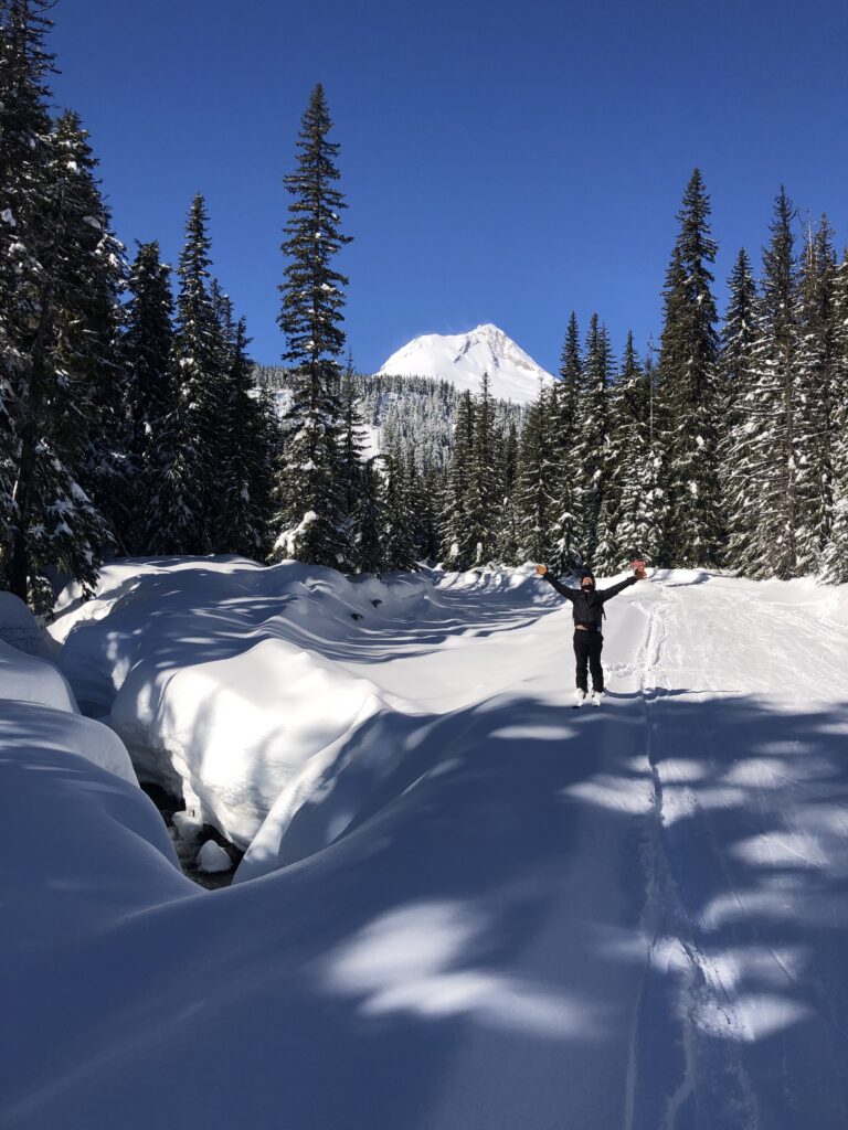
Photo by Melina Jacklet
Last modified: February 28, 2021


“What’s the best roofing material for long-term savings?”