The $25 million Mt. Hood Safety Project is just about complete, so expect fresh asphalt and a new concrete barrier to prevent cross-over head-on collisions. As for whether the improvements will improve traffic flow during the winter peak season, we’ll just have to wait and see.
The Oregon Department of Transportation and K & E Excavating are wrapping up the three-year project on time and on budget. The eight-mile stretch of Hwy. 26 from Rhododendron to Hwy. 35 has been widened, repaved and protected from landslides.
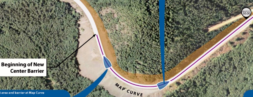
Some 289,000 cubic yards of rock and dirt have been excavated, 51,000 pounds of explosives detonated, 2600 tons of asphalt placed on U.S. 26. A new concrete barrier now extends for 1.6 miles down the middle of the highway, separating westbound and eastbound traffic. Workers have extended westbound passing lanes by 1,400 feet, improved drainage and addressed nearby rockfall hazards with slope stability efforts. The 314 trees that were cut down from slopes got hauled down and used for fish restoration projects in nearby creeks.
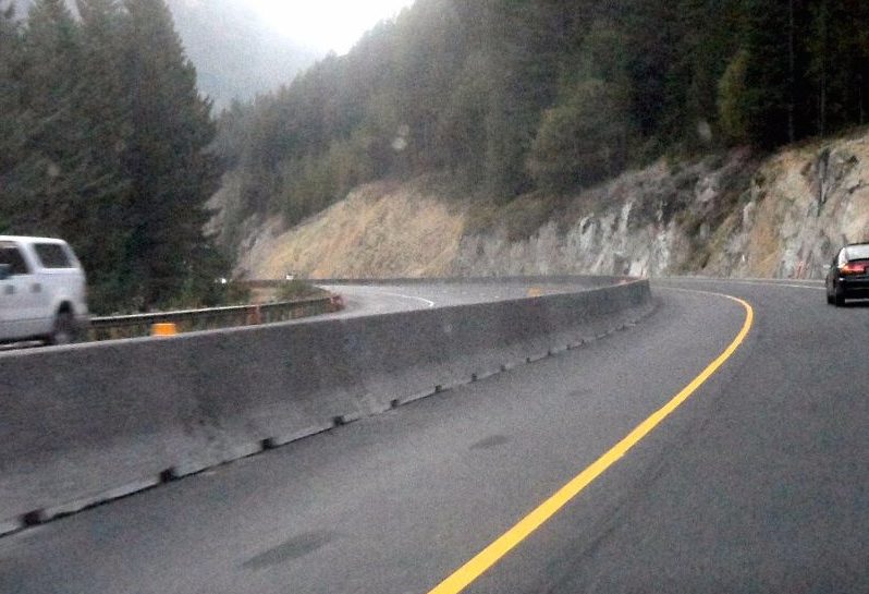
Here’s a shot of the new concrete barrier, taken by Robin Cressy on an overcast day:
Another photo from Emilio Trampuz, shot two weeks ago:
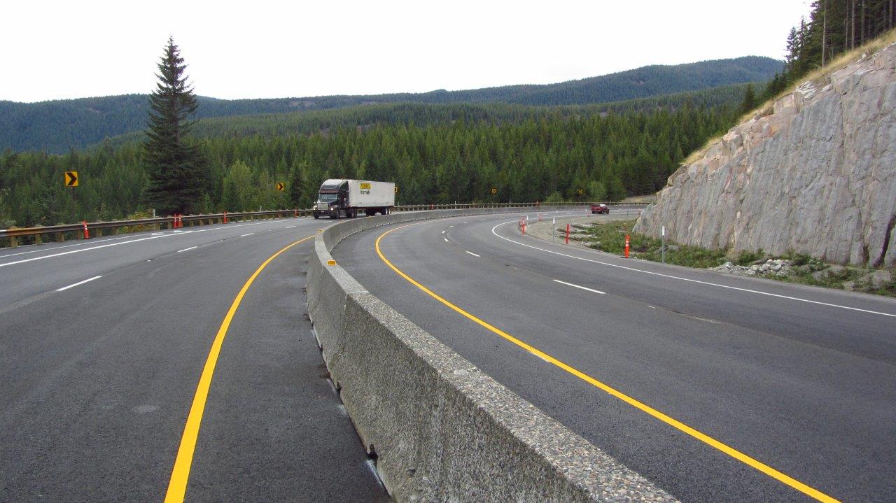
The barrier was built to prevent head-on collisions, so, hard to argue with that. It could, however, create a difficult, well, barrier in the peak of winter, when emergency vehicles sometimes need to travel down the middle of the highway to assist with collisions on icy roads. The barrier also blocks access to the Mirror Lake trailhead for westbound travelers.
Taken as a whole, the improvements will undoubtedly result in a safer main route from Metro Portland to Mount Hood and back. Unfortunately, the new Hwy. 26 does not address widespread traffic concerns about congestion between Hwy. 35 and Government Camp during peak weekends, nor does it add westbound lanes.
The nine-mile drive from Mt. Hood Meadows to Government Camp can take three hours or more when holiday traffic is at its worst, an annual problem exacerbated by poor design.
The problem is, the westbound portion of Hwy. 26 shrinks from two lanes to one lane at the worst possible point, at the top of a hill just after two big attractions and just before an even larger attraction in Timberline. It remains one lane through Govy while picking up traffic from Skibowl, creating a massive column of trapped vehicles in an area easily wide enough to accommodate a second westbound lane. The two lanes eastbound hardly have any traffic at all in the evening, because practically everyone is heading back to Portland. Drivers sit and stew, and some decide to break the law and pass everyone, and that’s when things get dangerous.
ODOT has no plans to add westbound lanes to key choke points on Hwy. 26. Instead they are focused on adding real-time electronic signs to inform drivers of road conditions and travel times at Meadows, Frog Lake and Timberline in 2017, encouraging transit and ride-sharing, and educating drivers about route options and safe winter driving tips.
The jury is out as to whether these initiatives will improve traffic flow during those weekends when 26 routinely backs up for miles. In the meantime, at least we will have some fresh new pavement to wait on next time traffic flow grinds to a halt.
ODOT and K&E Excavating will be hosting a completion celebration from 10 a.m. to noon, Friday, Oct. 28 at the Mount Hood Cultural Center and Museum. Please RSVP to [email protected] by Monday, Oct. 24. The Mount Hood Museum is located at 88900 Government Camp Loop, Government Camp, OR, 97028.
Last modified: October 7, 2016