UPDATE, 5 PM WED: Whoah! The temp dropped 10 degrees from noon to 5 pm on the mountain today. That bodes well for the latest monster storm.
What a difference a year makes.
One year ago, the snow situation on Mount Hood was desperate. Record high temperatures soared to an unheard-of 60 degrees at 6,000 feet, and precipitation was falling as rain instead of snow. Hood River Express, the Private Reserve, Heather and Clark Canyons, Cooper Spur, the Upper and Lower Bowls and Jeff Flood were all closed for lack of snow. It was the worst Mount Hood snowpack year on record through January.
Fast-forward a year, and allow yourself a large, contented smile. All Mount Hood terrain is open, from Reynolds Run to Clark Canyon to Cooper Spur. Snow depths as of 9 am Jan. 12th are 86 inches at Timberline, 77 inches at the base of Mt. Hood Meadows and 52 inches at Skibowl. In comparison, the snow depth was five inches if that one year ago at Skibowl.
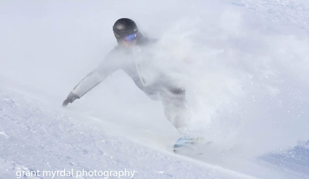
The extra snow has spread crowds far and wide and opened up all sorts of opportunities for first tracks. I shot this photo with my iPhone in Clark Canyon the other day:
The return of the snow has produced a plethora of powder whoops — and reinvigorated the Mount Hood snowsports scene with energy and money. The racing season is off and running. Freestyle competitions are coming soon. Money is flowing into resorts, shops and restaurants. Mountain traffic has been a mess.
The key question is, will the precipitation continue to fall as snow, or will it warm into rain? The forecast for this week is right on the edge. The freezing level is expected to rise to 6600 feet and then drop down to as low as 3,000 feet. But predicting freezing levels on Mount Hood is never an exact science, especially when the wind blows Pacific Ocean air in from the Southwest during an El Nino year.
Assuming the moisture takes form as snow instead of rain, we could see a foot or two of fresh snow this week. Or more. Or less.
On the bright side, the National Weather Service is forecasting 9-19” of new snow at 6,000 feet through Friday. The snow-forecast.com model is even more optimistic, predicting a whopping 27 inches at Mt. Hood Meadows through Friday and another 8.7 inches over the weekend.
On the other hand, Mt. Hood weather girl Temira sees a somewhat soggier immediate future, with a mixture of rain and snow all week, switching to rain Friday night and Saturday.
All we can do is hope the temperature will drop a few degrees on the right side of freezing as this powerful but hard-to-read wave of weather cycles through the Cascades.
{igallery id=3898|cid=5|pid=2|type=category|children=0|addlinks=0|tags=|limit=0}
Last modified: January 12, 2016