Parts of the long-abandoned Mt. Hood Loop Highway near Government Camp in Oregon should be preserved for both recreational and historic reasons. That effort would involve building two pedestrian bridges over Hwy. 26, but it would be worth it.
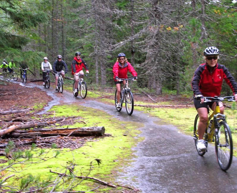
This old road used to be a highway, but is now overgrown with vegetation and reduced to a barely passable trail in many places. Here is a photo of a group of Mountain High Snowsport Club members bicycling on the remains of that old road:
In my opinion, the entire area should be preserved and connected for bicycling and hiking — and for historic reasons. Laurel Hill is part of the original Barlow Road, which was part of the Oregon Trail. In fact, this was the steepest part of the whole Oregon Trail, the place where the pioneers had to tie trees to the back of their wagons to act as a brake for the steep descent to the West.
Currently, it is very difficult to access Laurel Hill from Government Camp, because modern Highway 26 cuts right across the old highway. With the current safety improvements on Highway 26, once the concrete median barrier is installed, it will become impossible to cross the highway on foot or on a bicycle. Thus the need for pedestrian bridges.
As for recreational value, preserving this area could create a biking and hiking loop connecting Government Camp, Laurel Hill, and the Pioneer Bridle trail (which has recently been used mainly as a downhill bicycle trail). People biking down the Pioneer Bridle trail could return to Government Camp using the old Mt. Hood Highway, which includes the well-preserved Kiwanis Camp Road as well as the neglected parts of the old highway on Laurel Hill and just west of Government Camp.
What is needed is to build two pedestrian bridges to reconnect historic Laurel Hill with the two adjacent segments of the old highway which are now dead ends because the new highway cut right through them. The two pedestrian bridges would make it possible for people to access Laurel Hill from both Government Camp and from the town of Rhododendron downhill. Without pedestrian bridges, Laurel Hill will get more and more isolated and even harder to access, since walking or biking across Highway 26 in that area will no longer be possible.
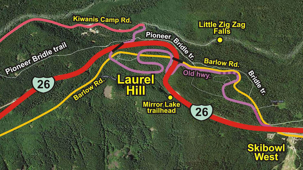
This map shows the location of the two proposed bridges, marked with short black lines across the red highway, several miles west of Government Camp, near the Mirror Lake trailhead on one side of Hwy. 26 and Laurel Hill on the other side. The yellow line shows the famous Barlow Road, part of the Oregon Trail since 1845. The purple line shows the old, abandoned Mt. Hood Highway, the first paved road from Portland to Mt. Hood.
For several years I have been leading an annual history tour of the Old Highway by bicycle, usually starting either at Timberline Lodge or at the Barlow Pass, and ending in Rhododendron, and visiting Laurel Hill along the way. Sadly this tour will be either impossible or very difficult to continue because access to Laurel Hill will be cut off.
I am not sure whether the Oregon Dept. of Transportation (ODOT) or the U.S. Forest Service would be the agency to decide and build these two pedestrian bridges. Most likely it would require cooperation between the two agencies and others. I plan to lobby these agencies to preserve this area, and I could use help from the community.
I have also contacted REI, which is about to invest large sums of money into preserving trails around the country.
With luck and effort, perhaps we will be able to preserve this historic area for biking, hiking and exploration.
Last modified: August 18, 2015