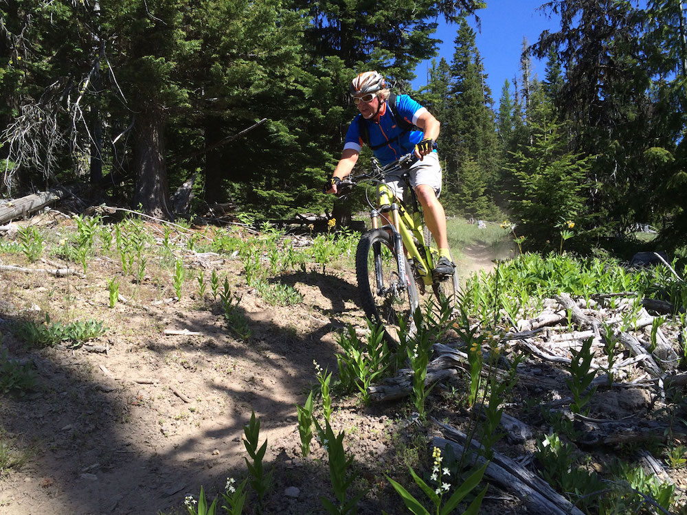
In the damp, shady forest on the western side of Mount Hood, there’s a magical system of trails so perfect it’s almost like it emerged fully formed out of a mountain biker’s dream.
It’s a flowing series of berms, drops, single-track and switchbacks that begs to be ridden over and over again. The 17-mile Sandy Ridge Trail System is the result of years of cooperation between many groups, spearheaded by the Bureau of Land Management (BLM). The effort spans more than a decade and continues to grow with the pending acquisition of an additional 200 acres that could add miles of trails and double the parking capacity.
150 new parking spaces and a new bike-washing area are part of the plan, but it is unclear how many new trails will result from the coming expansion. The BLM will have to do a National Environmental Policy Act (NEPA) analysis before building any new trails.
The NEPA process has held up numerous developments in the Mount Hood area over the years, including a long-delayed plan for mountain bike trails at Timberline. The Oregon Department of Fish and Wildlife has voiced concerns about potential impacts to elk populations and a few concerned landowners in the area also have voiced opposition, but no organized group has come out against the expansion of the Sandy Ridge trail system.
John Huston, field manager for the BLM’s Cascade Resource Area, said the additional space would be celebrated by as many as 120,000 shredders who hit the single-track there every year. “The use at Sandy Ridge has been greater than we ever imagined,” he said.
Designed by mountain bikers, for mountain bikers
The seed for Sandy Ridge was planted in 2006. The BLM had stockpiled nearly 15,000 acres of forest in the area through land purchases and swaps and was considering options for best use. Zach Jarrett, outdoor recreation planner for the BLM Oregon/Washington, led initial outreach meetings that included area residents and recreation groups as well as representatives from Oregon State Parks, U.S. Forest Service, National Parks Service and Oregon Department of State Lands, among others. The meetings focused on a simple question.
“We asked what were the needs of the community for recreation opportunities,” Jarrett said.
Through years of meetings and public comment, a clear answer emerged: The western side of Mount Hood was short on sanctioned mountain biking trails. Several miles of “unofficial” trails existed within the Sandy Ridge Project area, but there was potential for much more. The process resulted in the development of the Sandy River Basin Integrated Management Plan, which was approved in April 2009 and included plans for trail development.
Jarrett said the process was undertaken with gravity. “I had been mountain biking for 20 years and I had a pretty clear picture about what was available to people coming out of the Portland Metro Area,” he said. “We knew we had to really hit our mark. We knew it was going to be the only game in town for people coming out of Portland and it would get year-round use.”
The BLM undertook trail planning with the help of bike advocacy groups like the Northwest Trails Alliance, the International Mountain Bicycling Association (IMBA) and local community groups. The first trail, the 3-mile Hide and Seek, opened in the fall of 2009 and was a huge hit among Portland-area riders for its mountain-bike specific design. Unlike other nearby trails that see a combination of hiking, mountain biking and equestrian use, Sandy Ridge was built for mountain bikers by mountain bikers.
“Everybody yields to mountain bikers. We have directional trails, and on a busy day you could have 400 riders on Hide and Seek but you’ll hardly see anyone. It offers an uninterrupted trail experience on trails built from the ground up for mountain bikers,” Jarrett said.
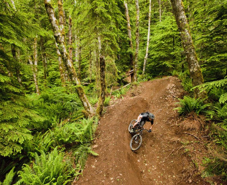
The Sandy Ridge network of mountain biking trails there includes an intentional mix of levels, with about 20 percent for beginners (green), 60 percent for intermediate riders (blue) and 20 percent for experts (black diamond). All of the trails are highly engineered by trail building experts with an eye for dynamics and flow of mountain bike riding to offer a high-quality trail experience. New trails opened every year from 2009 to 2014, culminating with Follow the Leader, a 2-mile flow trail that won a Model Trail Award from IMBA in 2014.
The design of Sandy Ridge has been so successful that it now serves as a model for the BLM’s national trail building efforts. “Sandy Ridge has been used to create optimized trail guidelines for a quality trail experience,” Jarrett said.
Huston said the trails also present a great example of sustainable recreation for the Sandy River basin. “Within that corridor mountain biking is an activity that we have been able to identify that is visually not intrusive. You can’t even tell there is a development there until you get right up to it.”
The network has already seen an estimated $10 million to $15 million spent, counting land purchases, and thousands of volunteer hours from bike advocacy groups and youth corps in trail building and maintenance. The pending addition of 200 acres carries a $1 million price tag. Access remains free to mountain bikers, although that may change in the future with possible parking fees and annual permits. In the meantime the BLM has installed a voluntary donation tube at the trailhead to help fund the maintenance and improvement of the trail system.
Then there’s the investment of local riders who love Sandy Ridge and ride the network in the heat of summer and the cold of winter. Riders who seek out the trails to climb, descend and repeat. Which sounds pretty magical all by itself.
Where to Ride: 3 Single-Track Mountain Bike Destinations Near Mount Hood
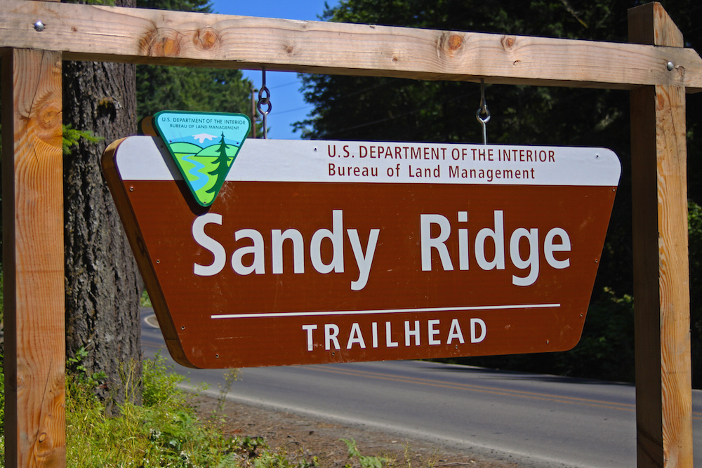
Sandy Ridge: 15 different trails make up 17 miles of trail at the Sandy Ridge Trail System. All trails are accessed via the initial 4-mile paved Homestead Road. From there, riders can connect with various loops like 3-mile Hide and Seek, 2-mile Three Thirty Eight and 2-mile Quid Pro Flow. To get to Sandy Ridge from Portland, head east on US Highway 26 (Mount Hood Highway) and turn left on Sleepy Hollow Dr soon after a large sign indicating a left turn for Marmot. NOTE: This will be the second turn-off for Sleepy Hollow Rd. Once on Sleepy Hollow, go 0.3 miles and turn right on E. Barlow Trail Rd and over the Sandy River. After 1 mile on E. Barlow Trail Rd, look on the left for the sign. Approaching from Mount Hood by bike, the trailhead is about 7 miles west of the downhill end of the Timberline-to-Rhododendron trail, accessed by East Barlow Trail Road and Homestead Road. There is parking for nearly fifty vehicles, a restroom and visitor information. No fees or permits required, although donations at the trailhead are appreciated, and parking fees and annual passes are future possibilities.
Surveyor’s Ridge: Just east of Mount Hood off of Highway 35, you’ll find 84 miles of single track in a network of 24 distinct trails in the Surveyor’s Ridge area. Mostly blue rides, the area is named for a 12-mile ridge trail that can be accessed from the north or south and ridden out-and-back for 24 miles with great views of the mountain. Nearby Eight-Mile and Knebal Springs loops are often ridden together for 13 miles of often dusty riding. Adjacent Fifteen-Mile Trail, with 3,000 feet of climbing, is not one for the faint-hearted (or hungover). For more information about this area, check the 44 Trails Association website. No fees or permits required, but people do need to display a NW Forest Pass to park at the trailheads.
Post Canyon: Three miles outside of Hood River, Post Canyon offers 35 miles of trail on county land. The majority of the trails here are rated blue, like the recently unveiled Float On, a steep descent that packs a surprising number of high-sided turns into a small area. There’s also a sprinkling of black diamonds (Bad Motor Scooter and Grand Prix) and some greens, like Kleeway, a fast and fun one-way descent that opened last summer. Connect with Post Canyon work parties and events through the Hood River Area Trail Stewards Facebook page. No fees or permits required. Please note that there is no parking lot at lower Post Canyon. It can get quite congested on the weekend. There is a small parking lot at the bottom of the Seven Streams Trail nearby that holds about 12 cars.
Big thanks to BLM for the excellent photos from Sandy Ridge, and for bringing high-quality, sanctioned single-track to the west side of Mount Hood.
{igallery id=8119|cid=77|pid=2|type=category|children=0|addlinks=0|tags=|limit=0}
Eileen Garvin lives and writes in Hood River, Oregon. When she’s not hunched over her keyboard or digging in the garden, you can find her mountain biking, kiteboarding, hiking, skiing or camping somewhere.
Last modified: June 24, 2016