In the wee hours of November 7, 2006, Mother Nature threw a tantrum on Mount Hood.
A Pineapple Express walloped the early snowfall on the 11,250-foot peak causing the collapse of an ice dam on Elliott Glacier and sending a massive slurry of debris down the Middle Fork of the Hood River. Sediment, truck-sized boulders and uprooted trees careened down the river, which jumped its banks in spots and covered OR-35. By 7:30 a.m., the USGS water gage at the Tucker Bridge had spiked to nearly 19,000 cubic feet per second (CFS), compared to 300 CFS the day before. The river foamed and churned its way 25 miles down the mountain to deposit an estimated 1.5 million cubic yards of sand into the slow-flowing Columbia River.
Locals who were out that morning recall the earthy smell — like mushrooms, one remembered — and the roaring, chocolate brown river that boiled over the Mount Hood Railroad trestle and under the I-84 overpass to mount a huge standing wave at the confluence of the Hood and Columbia rivers.
When the water died down, people took stock of the damage. The Oregon Department of Transportation reported 2.5 miles of washed out highway and demolished bridges and culverts. PacifiCorp discovered extensive damage to its pipeline below Powerdale dam, which would ultimately lead to its early decommissioning. With the highway closed, mountain ski areas faced delayed openings and disappointed pass holders. And Port of Hood River officials looked out their windows onto a massive pile of trees, root balls and boulders flung into the middle of the Columbia River onto a delta, or sandbar, that had grown by 26 acres.
“It blocked off the (Nichols) Boat Basin and looked like it would block access to the marina and the shipping channel,” said Michael McElwee, executive director of the Port of Hood River, who had then been on the job for just four months. “I still marvel at how much debris there was.”
Elsewhere in Hood River, a small but enthusiastic crowd was celebrating — local kiteboarders, who were the first to realize that the destructive flood event could be a boon to the Hood River waterfront. “I was one of many kiters who woke up with great excitement to see that massive change down there,” said Adam Lapierre, vice president of the Columbia Gorge Kiteboarding Association (CGKA).
Where others saw a giant mess, kiteboarders saw a kite beach. All that soft sediment that had poured into the river protruded above the waterline, filling in a sandbar that had been submerged there since at least the 1930s, according to historic photos. It didn’t ultimately block the shipping channel or the marina. But it morphed what had been a small, sketchy kiting area into a wide expanse of sand that would change the Hood River kiteboarding scene completely.
“Nobody thought it would be usable,” McElwee said. “After about two years it became one of the best kiteboarding venues on the West Coast.”
To understand why the Hood River sandbar had such a big impact on kiteboarding, one needs to understand the gear. Kiteboarding lines — 24 meters long — must be laid out carefully and evenly before launching. Kites need at least that much space to land. And the inflatable kites themselves are wide — typically 5 to 14 square meters.
With its powerful west-to-east winds and lively wave action in the Columbia River Gorge, Hood River has been a windsurfing center since the 1980s. Kiteboarding arrived more recently, starting in about 2000, but the Hood River waterfront was dominated by a grassy lawn renovated in the 1980s for windsurfing, and kiting was not allowed there. To the east was the Hood River marina and swim beach. Between the two was “the spit,” a skinny arm of sand on the east side of a decommissioned boat basin that disappeared frequently with fluctuating river levels. This was Hood River’s only sanctioned kite launch.
From here, a handful of locals kited and a couple of courageous schools operated. But the sport was very new, only about six years old, with gear that was difficult to use and unsafe compared to what would soon follow. Add to that a cramped launch area with fluky wind and submerged debris, and you had a kiteboarding spot that only the most competent could manage.
Lapierre, who also works at Slingshot Sports, a kiteboarding manufacturer based in the Gorge, maintains that the sandbar came at just the right moment. The serendipitous timing of the flood with improvements in gear and the birth of social media — the perfect medium for promoting the sport — gave kiting just the boost it needed.
“Because of the momentum it already had, kiting exploded in Hood River following the formation of the sandbar,” he said.
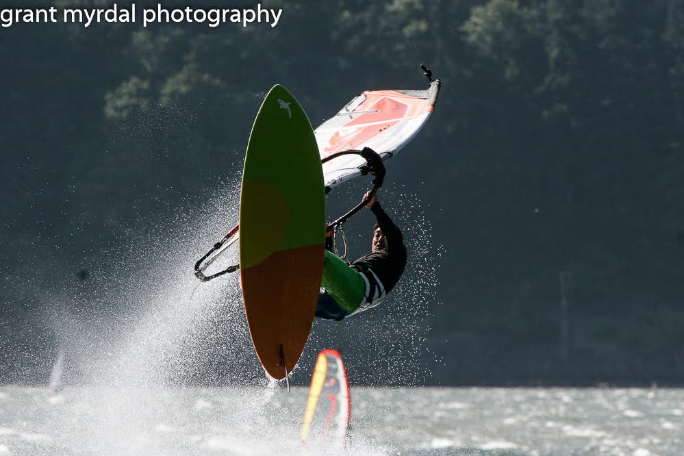
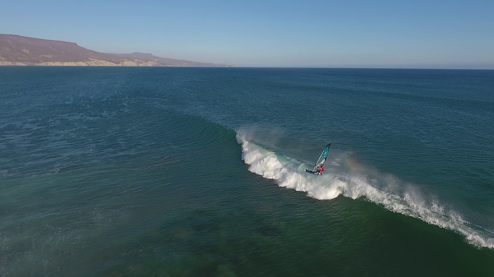
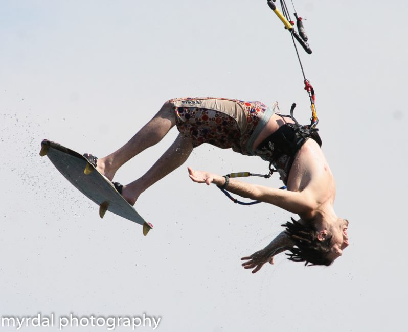
All of the photos accompanying this article were shot by Grant Myrdal at or near the sandbar.
A Multi-use Playground
A decade after the flood, the Hood River sandbar has become a destination for kiteboarders from around the world. While neither the Port nor CGKA tracks the numbers of kiteboarders using the sandbar during the season, people agree that use has grown exponentially since 2006, and it is not unusual to see 200 kites out on the water on a busy summer day, when winds exceed 20 miles per hour on 75 percent of days. The additional space created by the Sandbar allows for the operation of five kiteboarding schools, and kiteboarders now split the event site lawn with windsurfers. During the summer, kiters can pump up their kites on the event site grass before wading across a narrow channel to the wide, sandy expanse to rig and launch.
“It is a heck of a lot safer. There is more room and people who are learning how to kite are a lot more comfortable out there,” said Liz Whitmore, waterfront coordinator for the Port of Hood River.
Off-season, when high-water levels submerge the sandbar, kiters are allowed to launch and land from the event site grass. The cutoff date for that activity is determined by representatives from CGKA, the Columbia Gorge Windsurfing Association and the Port, who work together to make sure conditions are safe for everyone.
The community also collaborates for an annual spring cleanup, spearheaded by CGKA but drawing varied participants. The first cleanup was initiated in the spring of 2007 as CGKA recognized that something had to be done to reduce hazards to kiters, who could easily be injured by the trunks, rocks and stumps that remained strewn about on the sand. Winter floods leave a certain amount of debris on the delta each year, and many pitch in on the cleanup because as the years have passed, the waterfront area has become beloved to many people.
“You have so many activities going on there right now — kiteboarding, windsurfing, standup paddle boarding,” said Whitmore. “There is a new surf break, so you have kids playing in the waves and now you have hydro foiling.”
McElwee sees that diversity of use too, right from his office window.
“I look right at the sandbar and I’m amazed at the amount of use that occurs throughout the year. It’s really an extraordinarily well-used multi-use place and it changes all the time. It’s always a big surprise what you are going to find out there.”
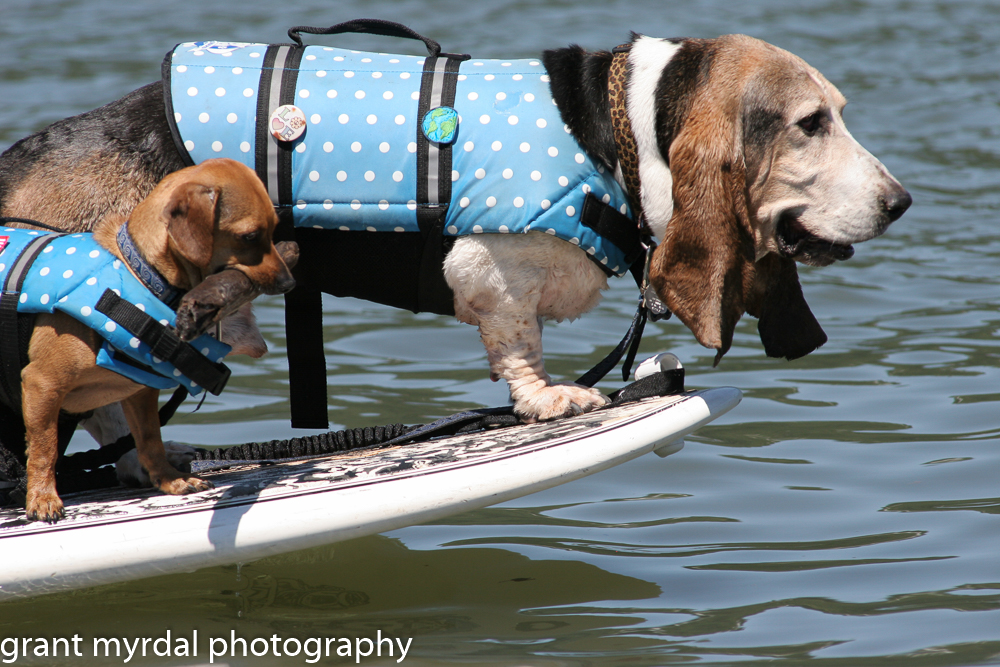
On a recent spring day, a stroll along the sandbar reveals this varied use. Dogs race along the eastern edge, where rails and jumps jut above the water in what is the only public kiting terrain park in the U.S. The wind picks up and a scrum of middle school aged kids takes turns piloting trainer kite through the gusts and lulls. On the western edge, kiteboarders launch and head upriver toward the White Salmon Bridge. Others land, and come in to call it a day, heading to the parking lot to hang out and drink a beer. A 30-something couple in wetsuits waddles behind their instructor, geared up and nervous as they head to the far end of the sandbar, which is empty of people.
The high water this day has created small islands out of the sandbar, so one has to wade across small cold water channels to reach the northern edge. It’s a reminder that the sandbar continues to morph and change, buffeted by the wind, the waves and the current. From the south, the Hood River flows into the Columbia, serene and clear in the spring sunshine with no trace of the mayhem of 2006. And upriver, Mount Hood, still snow covered in May, isn’t hinting at what might come next.
{igallery id=1351|cid=75|pid=2|type=category|children=0|addlinks=0|tags=|limit=0}
Eileen Garvin lives and writes in Hood River, Oregon. When she’s not hunched over her keyboard or digging in the garden, you can find her mountain biking, kiteboarding, hiking, skiing or camping somewhere.
Last modified: May 19, 2016